Updated 5/4/16
For all you cyclists (and walkers), our local botanic gardens has just completed a 1.5 shared pathway that is part of a grander plan in the Macarthur area – read on.
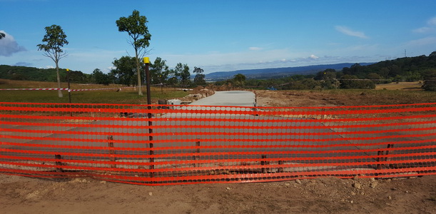
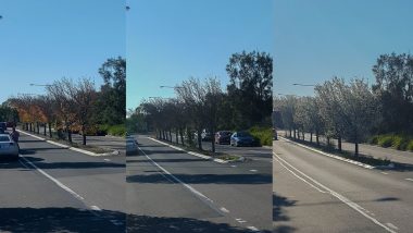
As a regular visitor to the gardens because of my mountain biking obsession, I have noticed that another construction had been taking place the last few months.
One of the shared trails I frequent has been concreted over with some extension work also – this is in the area in the south of the gardens (up the hill from the blue tree).
What is it? As I found out from reading the Camden Advertiser, it is the first completed section of the 14Km ‘Macarthur Regional Recreational Trail‘.
The recreational trail will act as a shared pathway for both cyclists and pedestrians when it is expected to be open in early November.
When the remaining sections of the trail are completed, it will go from Camden town centre, through the Mount Annan botanic gardens, and down to Macarthur railway station.
So where will the cycle path go? It’s not a straightforward answer but I did get some info from Camden Council (still waiting from a response from Urbangrowth NSW ……).
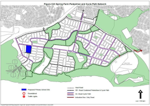
Details of the path network within Spring Farm can be found on Page C67 of the Camden Development Control Plan. On that page, there is this map.
Details of the path network within the University of Western Sydney can be found on Page 2-7 of the Campbelltown Council Development Control Plan . On that page is the following map:
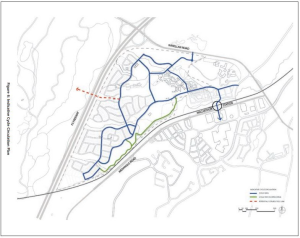
See the red dotted line? That is labelled ‘potential future cycle path’ According to council, funding is being sought for the connection of the path to the UWS precinct.
The length and endpoints are quite exciting, and will potentially encourage cyclists to ride to the railway station to commute – if doen properly. At the moment, I would not even attempt to cycle along Narellan Road to Campbelltown.
I thought it would be an idea to grab a couple of photos during the work for historical purposes (Botanic Gardens, feel free to contact me for the full size pics). Note: as of the updated post, the path within the gardens is open.


Good luck with finding out the route for the proposed 14km track !
How will it cross the Hume Hwy ?
How will it cross the Camden Bypass ?
What of a link from Camden to Narellan, to join the (excellent) bike path along most of Camden Valley Way ?
The hope is that this will allow a bike path commute from Camden to Prestons, to then join the M7 Bike Path.
I’ve searched via google, combed the website of UrbanGrowth NSW – no map of the proposed route.
🙂
Thanks for the info, Bill. I thought it was just me that couldn’t find any info 🙂