For updated info, please see our October 2015 post.
What is happening with the decision of Sydney’s second airport at Badgerys Creek? That seems to be what everyone in the Macarthur area is wondering lately.
Every few days you see something in the media, with supposedly a decision being made soon. Don’t forget this has been going on for about 30 years, but seemed to be in the final stages of the decision back in November last year when Tony Abbott indicated that the site would be good for Sydney’s 2nd airport (see this story). Funnily enough, it already has its own international airport code (SWZ) and is called Sydney West Airport – if all that sticks given a green light I’m not really sure.
I think in some respects the airport may be good for Western Sydney but the infrastructure in the surrounding areas has to be upgraded substantially. The current state of the road and rail network is not even close to what it needs to be if an airport was to be built at Badgerys Creek.
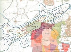
How much will it affect people in the Narellan and and Mount Annan areas? It largely depends on the flight paths and thus the placement of the airport runways at Badgery’s Creek. There are currently 3 options for the runways, shown below (sorry for the poor size).
The best option for a flight path at Badgery’s Creek which would probably not affect residents in the Macarthur area is runway option A. See graphic below (source: google.com) for affected areas if Option A was adopted:
Option B would possibly bring aircraft noise to the local area, as would option C. It has been written in the media that parts of Camden and St Clair would be affected by some flight noise if Option C was adopted.
On the in the environmental front, apparently due process has written off the site as inappropriate for a 2nd airport because of air quality, noise pollution, risks to our water supply and ecological sustainability.
Locals of the area would be well aware that Badgerys Creek suffers from fog, which is an operational nightmare for any airport.
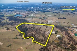
Where the airport would exactly be located can be shown in the aerial pic below (source: google.com). To the left of the pic (out of view) would be be Elizabeth Drive running from top to bottom.
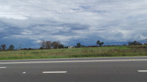
Shown below is what the area currently looks like, with these photos taken earlier this week from Badgery’s Creek Road, looking West. I had to add the rickety sign from the local park, as I’m not sure how much longer it will remain up.


The pollution problem will affect residents in our area even if we escape the 24 hour operation of continuous noise pollution.We are the highest polluted area in Sydney now, due to pollution streams directly from Wolongong and Sydney being trapped by the mountains and huge residential developments ,unlike Mascot with open ocean and clearing sea breezes.
Depending on the flight paths ,Warragamba would be under pressure from contamination,
Expansion at Mascot or lift the curfew,is the only logical action ,even though nothing needs to be done for 20 years.
Agree, Kevin. Noise is one type of pollution that needs to be assessed. There are others to be considered for Badgerys.
Just what western Sydney needs an airport (not). So now we are being dumped with airport noise out in the west. Add this to no infrastructure to get there and this will just become a freight airport. What person from the city is going to want to travel all the way to Bagerys Creek to get on a plane? Build it in Gosford or Goulburn.
Personnally I don’t know what all you wowzers are winching about. The airport will not only bring much needed infrastructure to the West, it will lift the economy for the Cumberland County and provide sustainable growth and employment for the next ten years. Everyone’s a winner!!!